A multi-dimensional spatial policy model for large-scale multi-municipal Swiss contexts
ISTP PhD Candidate Michael Walczak assessed Switzerland's spatial policy which rejects the use of new land in favour of promoting densification. Using the agglomeration of Lausanne as a case study, he applied an automated spatial policy model to assess building reserves that are still available within the current building regulatory framework.
Abstract
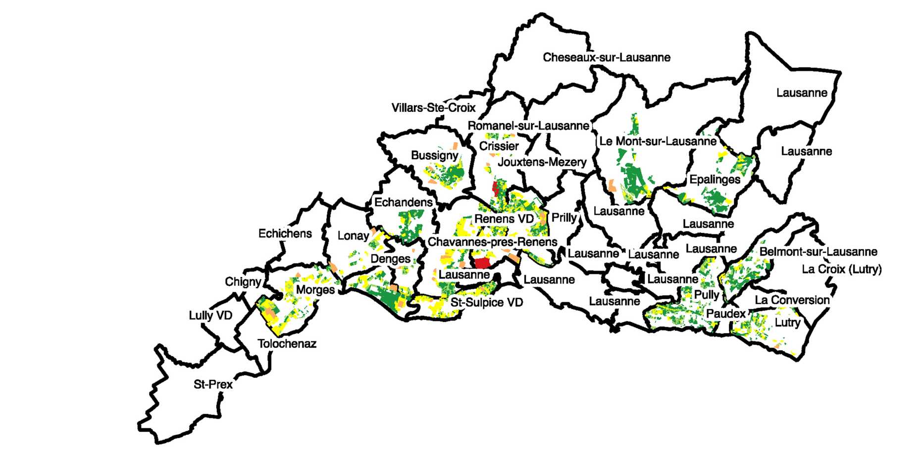
Switzerland’s widely adopted spatial policy rejects the use of new land in favour of promoting the densification of existing buildings or brownfield developments. However, to date there has not been an assessment of the volumetric building reserves that are still available within the current building regulatory framework. This paper addresses this lacuna using a case study of the agglomeration of Lausanne. An automated spatial policy model with particular focus on building density and its volume in residential and mixed-use areas allows for building policy to be quantified, assessed and evaluated on a countrywide scale since it takes the location of the building lot into consideration and cross-references it with the correct building regulation. Three-dimensional comparison allows us to identify whether the maximum volume permitted under the building regulation is greater than the current existing building volume. For the test case, spatial policy model identified 38 hectares of available square metres for densification (‘building surplus’ in the context of existing buildings, either in the form of extending existing buildings or infill development) and 93 hectares of square metres available for new developments (brownfield development of vacant or derelict open land) of residential and mixed-use buildings. At the same time, almost all areas are allocated beyond Lausanne’s inner-city boundaries.
- Article: external page A multi-dimensional spatial policy model for large-scale multi-municipal Swiss contexts
- Journal: Environment and Planning B: Urban Analytics and City Science (2021)
- Author: Michael Walczak